Sunday, July 6 2025 - Welcome
Top Posts
The Secret Pyramids China Doesn’t Want You To...
Unveiling Pre-Clovis: The Page-Ladson Site
The Truth About Minot, North Dakota’s Nuclear Base
Secrets of the Ecuadorian Pyramids of Cochasqui
Ancient Rock Art Unearthed in Colombia’s Serranía de...
Mysterious Council Circle of Wichita
The Olmec Civilization
The Tunguska Event: Origins Explained
COINTELPRO: A Dark Chapter in American History
Devil’s Tower: Earthly Wonder or Alien Beacon?
Documentify TV
  • Home
  • Articles
Category:

Ancient Mysteries

**Ancient Mysteries**: This category delves into the enigmatic and fascinating world of our ancient past. It explores the mysteries that have puzzled historians and archaeologists for centuries. From the Pyramids of Egypt to the lost city of Atlantis, from the cryptic Nazca lines to the enigmatic Stonehenge, “Ancient Mysteries” offers a captivating journey through the annals of history. It invites readers to question, explore, and uncover the secrets that lie beneath the sands of time. Join us as we unravel the riddles of our ancestors and shed light on the wonders of the ancient world.

A man looking at a mysterious looking pyramid in China.
Ancient MysteriesArticlesUncovering The Truth

The Secret Pyramids China Doesn’t Want You To Know About

by documentifytv.com 9 March 2024
written by documentifytv.com 3 minutes read

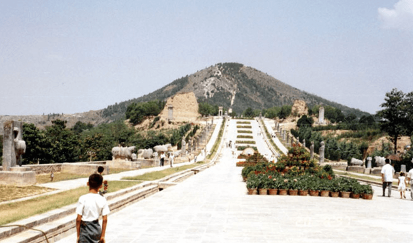
In the heart of China, hidden from the prying eyes of tourists and the scrutiny of archaeologists, lie ancient enigmas shrouded in secrecy. These are the pyramids of China, a topic that has intrigued and mystified the world, perhaps by design. Our journey into the heart of this mystery begins in the early 1990s with Hartwig Hausdorf, a German investigator whose quest for a colossal pyramid seen in earlier photographs led him to an unexpected discovery. Hausdorf encountered not the ancient marvel he sought, but a meticulous patrol by the Chinese military, guarding the secrets of the area. This encounter inspired him to pen “The White Pyramid,” a book that, while failing to unveil the pyramid he sought, illuminated other structures hidden in the region and sparked global curiosity.

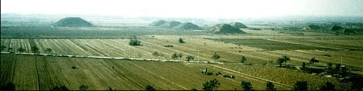
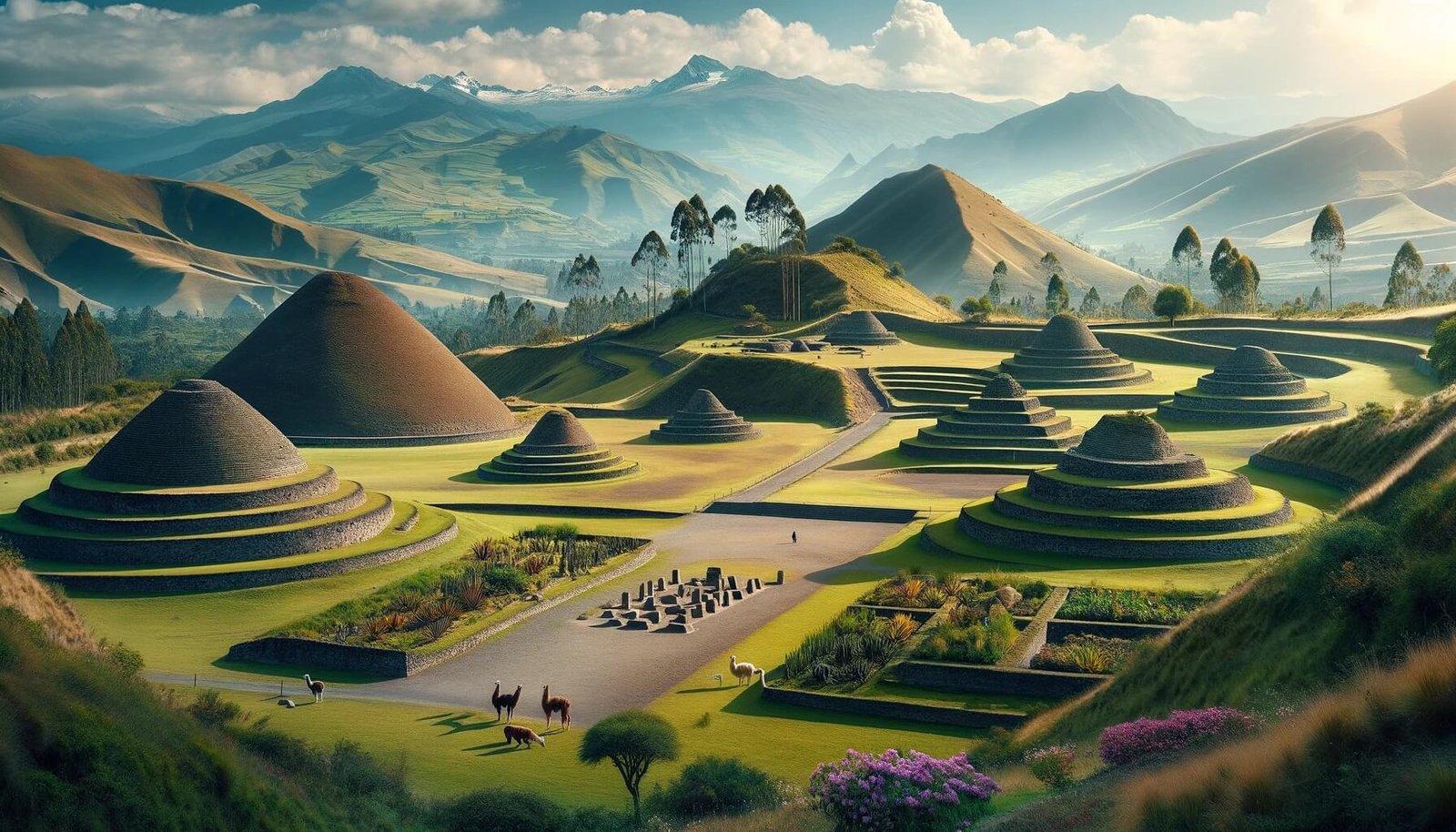
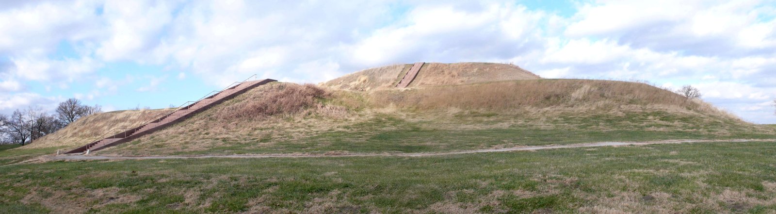
The turn of the millennium brought an official acknowledgment from Chinese officials, revealing the existence of approximately 400 pyramids north of Xi’an. Yet, the elusive White Pyramid remained outside this count. Unearthed at many of these sites were mausoleums, distinct in their resemblance to Mesoamerican pyramids rather than their Egyptian counterparts, with their flat tops and vegetation-covered exteriors. These ancient tombs, home to China’s royal ancestors, were designed to remain undisturbed for eternity, their existence barely perceptible, camouflaged by the lush landscapes of mountains, hills, tall grass, and trees. The Chinese government has been reticent to open these sites to exploration, citing concerns over potential damage by overzealous archaeologists and tourists. They argue that the wait is for a time when technology can allow for the safe unveiling of the pyramids’ ancient secrets, some of which date back 8,000 years.

Astrological Marvels: The Pyramids of Xi’an and the Stars

Modern technology has peeled back some layers of this mystery, charting the locations of the Xi’an pyramids and uncovering their astonishing spatial relationships. Researchers have been captivated by the precise astrological alignment of these mausoleums. While many align with the cardinal directions, with a significant number pointing true North, some veer off by about 14 degrees. This deviation is not arbitrary; computer analyses suggest a celestial connection, aligning these structures with the Gemini constellation as it appeared on the spring equinox in 10,500 B.C.

Conspiracies and Celestial Theories

Where secrecy and mystery reign, conspiracy theories flourish. The Chinese pyramids are no exception, becoming a fertile ground for speculation about their purpose, energetic properties, and astronomical significance. Some theories draw parallels with the ancient astronaut hypothesis, suggesting extraterrestrial involvement in their construction. Such conjectures point to a profound relationship between the rulers of ancient China and the cosmos, where alignment with the Earth’s cardinal points signified supremacy even in death.

Visible Yet Veiled: The Pyramids in the Digital Age

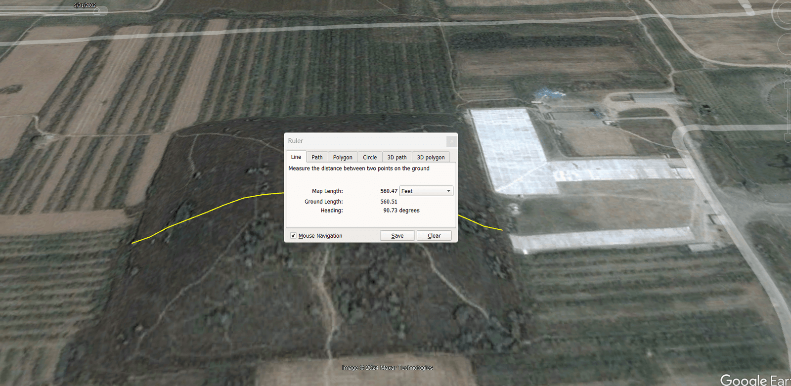
Today, with the aid of Google Earth, the curious eyes of the world can glimpse these ancient structures from afar, revealing around 40 known pyramids. Yet, even with modern technology, many remain hidden, cloaked by nature, their secrets guarded as fiercely as ever. This region, with its royal tombs and ancient mysteries, stands as China’s counterpart to Egypt’s Giza and the Valley of the Kings, a testament to a rich heritage and a civilization’s enduring legacy.

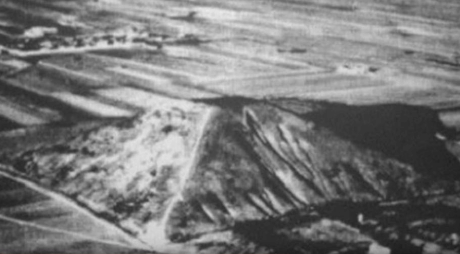
The saga of the Chinese pyramids began with an aerial photograph taken by Colonel Maurice Sheahan in 1947, offering the world its first glimpse of these monumental structures scattered across the plains around Xi’an. This photograph sparked curiosity and laid the groundwork for a narrative that continues to unfold.

As the Chinese government cautions patience, citing the need for technological advancements that could ensure the preservation of the pyramids’ contents, the world waits. Perhaps, like the discovery of King Tut’s tomb, the eventual unveiling of these ancient Chinese secrets will offer a new chapter in our understanding of human history, one that bridges the past with the future and the earth with the stars.

The famous 1947 photo taken by an airline pilot of the famed White Pyramid in China
9 March 2024 0 comments
0 FacebookTwitterPinterestThreadsBlueskyEmail
A panoramic view of the ancient pyramids of Cochasqui, Ecuador, showcasing several truncated pyramids and burial mounds set against a lush Andean landscape.
Ancient MysteriesArticles

Secrets of the Ecuadorian Pyramids of Cochasqui

by documentifytv.com 12 March 2024
written by documentifytv.com 3 minutes read

Ecuador, a country celebrated for its rich history, vibrant culture, and breathtaking natural landscapes, is also home to some of the most enigmatic and ancient pyramids in the world. Nestled approximately 30 kilometers northeast of Quito, the capital city, lies Cochasqui, the most significant and expansive complex of pre-Columbian and pre-Inca ruins in northern Ecuador. This archaeological marvel spans an area of 84 hectares, featuring 15 truncated pyramids and 21 burial mounds, known locally as tolas. But the site offers more than just historical structures; visitors can explore several small museums, a botanical garden, and even a llama farm, making it a comprehensive cultural experience.

The Architects of Cochasqui

The Quitu-Cara culture, comprising the Cara and possibly the Caranqui people, is credited with constructing these monumental pyramids between 950 CE and the Spanish conquest in the 1530s. This civilization, which established Quito, one of South America’s oldest capital cities, played a pivotal role in the region’s pre-Inca history. The Caranqui, known for their staunch resistance against the Inca invasion, contributed significantly to the area’s rich historical tapestry, with their leader Atahualpa becoming the last Inca emperor to resist the Spanish conquistadors.

Construction Secrets Unveiled

Crafted from cangahua, a soft volcanic stone abundant in the region, the pyramids of Cochasqui are a testament to the ingenuity of their builders. Despite its susceptibility to weathering and erosion, cangahua’s ease of manipulation allowed the ancient architects to create these enduring structures, which have been preserved over centuries partly due to the protective cover of grass overgrowth. Employing simple tools and techniques such as dry stone masonry, the constructors achieved feats of engineering that continue to awe modern observers.

Purpose and Significance

Beyond their architectural marvel, the pyramids served multifaceted purposes, from ceremonial and astronomical functions to political and military uses. They were centers for observing celestial movements, determining agricultural calendars, and conducting rituals. The pyramids and tolas also served as symbols of power and places of burial for the elite, adorned with various artifacts that provide insight into the cultural and spiritual life of the ancient inhabitants.

Today’s Relevance

The Cochasqui site stands as a beacon of cultural heritage and national pride for Ecuador. Recognized as a Cultural Patrimony of Humanity by UNESCO, it attracts visitors worldwide eager to connect with the ancient history and enduring legacy of Ecuador’s indigenous peoples. The site’s preservation and promotion as a center for cultural events and educational activities underscore its importance not just as a historical monument but as a living museum that bridges the past, present, and future.

The pyramids of Cochasqui are more than mere structures; they are symbols of resilience, creativity, and the indomitable spirit of Ecuador’s indigenous ancestors. Their secrets, from the construction techniques to the astronomical knowledge embedded in their design, continue to fascinate scholars and laypeople alike. As we explore and appreciate these ancient wonders, we are reminded of the rich tapestry of human history and the invaluable lessons it holds for us today.

In uncovering the secrets of the Ecuadorian pyramids of Cochasqui, we gain not only knowledge of a bygone era but also a deeper understanding of the complexities and achievements of human civilization. These ancient monuments invite us to reflect on our place in the world’s continuum and inspire us to preserve and cherish our cultural heritage for generations to come.

12 March 2024 0 comments
2 FacebookTwitterPinterestThreadsBlueskyEmail
Ancient MysteriesArchaeology

Ancient Rock Art Unearthed in Colombia’s Serranía de la Lindosa

by documentifytv.com 22 February 2024
written by documentifytv.com 3 minutes read

Introduction

Archaeologists have recently made an astounding discovery in Colombia’s Serranía de la Lindosa: a collection of rock art dating back an incredible 13,000 years. This remarkable find sheds new light on the ancient civilizations that once thrived in this region, offering a glimpse into their rich cultural heritage. Through careful analysis and interpretation, experts are uncovering fascinating insights into the lives and beliefs of these early inhabitants.

The Significance of the Rock Art

The rock art found in the Serranía de la Lindosa is of immense importance to our understanding of prehistoric cultures. These intricate and beautifully preserved paintings provide a window into the past, allowing us to glimpse the artistic expression and symbolism of ancient civilizations.

One of the most striking aspects of the rock art is its sheer age. Dating back 13,000 years, these paintings predate the famous cave art of Europe’s Ice Age by several millennia. This challenges previous assumptions about the origins of rock art and suggests that artistic expression was a fundamental part of human culture much earlier than previously believed.

Furthermore, the variety and complexity of the imagery found in the Serranía de la Lindosa rock art are truly remarkable. The paintings depict a wide range of subjects, including animals, humans, and abstract symbols. This diversity suggests a sophisticated understanding of the natural world and a complex belief system.

Interpreting the Rock Art

Deciphering the meaning behind ancient rock art is a challenging task, as it requires a deep understanding of the cultural and historical context in which it was created. Archaeologists and anthropologists are working tirelessly to unravel the mysteries hidden within the Serranía de la Lindosa rock art.

One prevailing theory is that the paintings served a ritualistic or ceremonial purpose. The presence of animal figures, such as jaguars and snakes, suggests a connection to shamanic practices and beliefs. These animals may have held symbolic significance, representing spiritual entities or serving as guides in the spiritual realm.

Another interpretation is that the rock art served as a form of storytelling, conveying myths, legends, and historical events. The intricate details and narrative elements found in some of the paintings support this theory, hinting at a rich oral tradition passed down through generations.

Preserving and Protecting the Rock Art

The discovery of the rock art in the Serranía de la Lindosa highlights the need for its preservation and protection. These ancient paintings are delicate and vulnerable to damage from natural elements and human activity. It is crucial that steps are taken to ensure their long-term survival.

Efforts are being made to document and record the rock art in detail, using advanced imaging techniques and 3D modeling. This not only helps in understanding the art but also serves as a valuable resource for future research and conservation.

Additionally, raising awareness about the significance of the rock art among local communities and the general public is essential. By fostering a sense of pride and ownership, we can encourage the preservation of this cultural heritage for generations to come.

Conclusion

The discovery of 13,000-year-old rock art in Colombia’s Serranía de la Lindosa is a momentous find that deepens our understanding of ancient civilizations and their artistic expressions. Through careful analysis and interpretation, experts are piecing together the story of these early inhabitants, shedding light on their beliefs, rituals, and cultural practices.

Preserving and protecting this invaluable heritage is of utmost importance. By safeguarding the rock art, we ensure that future generations can continue to learn from and appreciate the rich history of Colombia’s Serranía de la Lindosa.

22 February 2024 0 comments
0 FacebookTwitterPinterestThreadsBlueskyEmail
An ancient medicine wheel that was used in many North American First Nations People. This representation is from the Mysterious Council Circle of Wichita: Unearthed by Drones
Ancient MysteriesArticlesUncovering The Truth

Mysterious Council Circle of Wichita

by documentifytv.com 1 March 2024
written by documentifytv.com 2 minutes read

The Wichita Nation

The Wichita people, also known as Kitikiti’sh, trace their roots back to the Caddoan linguistic family. Their ancestral lands stretched from the Red River in Arkansas north to Nebraska. They emerged as a distinct group in present-day Oklahoma, Kansas, and Texas.

The Wichita Nation fostered a culture deeply intertwined with the cycles of nature. They were originally hunter-gatherers, moving with both weather and game through the Southern Plains. Around 900 CE, they adopted agriculture, establishing farming villages along the Washita and South Canadian Rivers in present-day Oklahoma. They were known as master traders, building an intricate network of exchange among various indigenous tribes and, later, European settlers.

Their homes were constructed from the prairie itself, crafting grass houses that stood against the Great Plains’ gusts. Their villages were centers of agricultural productivity, where they meticulously cultivated their staple crops of corn, pumpkins, and tobacco. Social structure in Wichita tribes was inextricably linked with the bison hunt. Hunters, revered for their prowess, organized communal hunts crucial to the tribe’s survival and social cohesion.

Archaeological findings have shed light on the Wichita’s past. A Dartmouth-led study using multisensory drones revealed a large circular earthwork at what may be Etzanoa, an archaeological site near Wichita, Kansas. This earthwork may be the remains of a so-called “council circle,” as it is similar to several other circular earthworks in the region.

In another instance, Wichita State University’s Dr. Crystal Dozier led a team of students in a cultural resource management project for the city of Wichita. The team dug holes every 15 meters, unearthing three isolated pieces of lithic debitage, which are pieces that have flaked off in the process of making stone tools.

From their precontact way of life to their current standing, the Wichita’s past encapsulates a saga of persistence and cultural endurance on the North American continent. Their history reflects the broader narrative of indigenous survival and adaptation in the face of expanding European colonization.

1 March 2024 0 comments
0 FacebookTwitterPinterestThreadsBlueskyEmail
Ancient Mysteries

The Olmec Civilization

by documentifytv.com 11 February 2024
written by documentifytv.com 5 minutes read

See how this amazing civilization was the precursor to the Maya and the Incan

The Olmec civilization is widely regarded as the first major civilization in Mesoamerica, a region that encompasses much of modern-day Mexico and Central America. The Olmec culture flourished from about 1200 BCE to 500 BCE, and is known for its monumental art, complex religion, sophisticated political and social organization, and influence on later Mesoamerican cultures.

The origins of the Olmec civilization are still a matter of debate among scholars. Some suggest that the Olmec were descendants of an earlier culture known as the Mokaya or the Mixe-Zoque, who inhabited the same region. Others propose that the Olmec emerged because of migration, trade, or cultural diffusion from other regions of Mesoamerica or beyond.

Origins and Geography

The Olmec heartland was located along the Gulf Coast of Mexico, in the present-day states of Veracruz and Tabasco. This area was rich in natural resources, such as fertile soil, abundant water, tropical forests, and mineral deposits. The Olmec exploited these resources to develop a complex agricultural system, which allowed them to produce a surplus of food and support a large population.

The Olmec also established trade networks with other regions, such as the highlands of Oaxaca and Guatemala, the Pacific Coast, and the Valley of Mexico. They exchanged goods such as obsidian, jade, serpentine, mica, rubber, pottery, feathers, and mirrors. Through trade, the Olmec also spread their cultural and religious influence, creating what some scholars call the “Olmec horizon” or the “Olmec sphere”.

Art and Architecture

The Olmec are best known for their monumental art, especially the colossal stone heads that have been found at several sites. These heads, which range from 1.5 to 3 meters (5 to 10 feet) in height and weigh up to forty tons, are believed to represent rulers or deities of the Olmec. They display distinctive facial features, such as thick lips, broad noses, and almond-shaped eyes, as well as headdresses and helmets. The heads were carved from basalt, a volcanic rock that was transported from distant quarries, sometimes over one hundred kilometers (60 miles) away.

The Olmec also created other forms of sculpture, such as thrones, altars, stelae, and portable objects. These sculptures often depict human or animal figures, or a combination of both, in various poses and expressions. Some of the most famous examples are the jade masks, the feathered serpent, and the wrestler. The Olmec used a variety of materials, such as jade, serpentine, greenstone, hematite, and ceramic, to create their sculptures. They also used techniques such as carving, polishing, incising, and painting to enhance their artistic effects.

The Olmec also built impressive architectural complexes, which served as ceremonial and political centers. These complexes consisted of earthen mounds, platforms, plazas, and pyramids, arranged in symmetrical patterns. Some of the most important sites are San Lorenzo, La Venta, Laguna de los Cerros, and Tres Zapotes. At these sites, the Olmec also constructed ball courts, where they played a ritual game involving a rubber ball. The ball game was a common feature of Mesoamerican cultures and had religious and social significance.

Religion and Society

The Olmec religion was based on a pantheon of gods and supernatural beings, who were associated with natural phenomena, such as rain, sun, earth, and maize. The Olmec also believed in a dualistic cosmology, where the world was divided into three realms: the sky, the earth, and the underworld. The Olmec performed rituals and ceremonies to communicate with the gods and maintain the cosmic order. These rituals included offerings, sacrifices, cave ceremonies, pilgrimages, and bloodletting.

The Olmec society was organized into a hierarchical structure, where the rulers and elites had privileged access to resources, power, and prestige. The rulers were intermediaries between the gods and the people and were responsible for ensuring the well-being of the society. The elites were composed of priests, nobles, warriors, and artisans, who supported the rulers and participated in the administration and production of the society. The commoners were most of the population, who worked as farmers, anglers, hunters, and traders, and provided the labor and tribute for the society.

The Olmec also developed a system of writing and a calendar, which are among the earliest in Mesoamerica. The Olmec writing consisted of symbols and signs that represented words, syllables, or concepts. The Olmec calendar was based on a 260-day cycle, composed of thirteen numbers and 20-day names, which was used to mark religious and ceremonial events. The Olmec writing and calendar influenced later Mesoamerican cultures, such as the Maya, Zapotec, and Aztec.

Decline and Legacy

The Olmec civilization declined around 500 BCE, for reasons that are not fully understood. Some factors are environmental changes, social unrest, internal conflicts, external invasions, or a combination of these. Many Olmec sites show evidence of deliberate destruction, such as the mutilation of sculptures, the burning of buildings, and the abandonment of settlements.

The Olmec civilization, however, left a legacy for the subsequent cultures of Mesoamerica. The Olmec are considered to be the “mother culture” or the “first civilization” of Mesoamerica, as they established many of the cultural patterns, artistic styles, religious concepts, and political institutions that were adopted and modified by later cultures. The Olmec also contributed to the development of science, mathematics, astronomy, and writing, which were essential for the advancement of Mesoamerican civilization.

The Olmec civilization is still a source of fascination and mystery for scholars and the public alike. The Olmec continue to inspire research, exploration, and appreciation of their remarkable achievements and contributions to the history of humanity.

11 February 2024 0 comments
1 FacebookTwitterPinterestThreadsBlueskyEmail
https://youtu.be/mTJRpaoJCK4?si=nAyBKpD3aMeUsjmx
Ancient MysteriesUncovering The Truth

Devil’s Tower: Earthly Wonder or Alien Beacon?

by documentifytv.com 10 January 2024
written by documentifytv.com 2 minutes read

Devil’s Tower, a 511-foot tall, fluted rock monolith rising from the plains of northeastern Wyoming, has captivated hearts and imaginations for centuries. Its distinctive hexagonal columns, radiating cracks, and sheer improbability against the flat landscape have fueled a persistent fire of speculation about its origins and purpose.

Among the most intriguing theories are those suggesting extraterrestrial connections. Proponents of these ideas point to several factors:

Unusual Geology

Devil’s Tower is not volcanic, sedimentary, or metamorphic like most mountains. Instead, it’s composed of igneous rock, specifically phonolite porphyry, formed deep within the Earth’s crust and then pushed upwards by volcanic forces millions of years ago. This unique composition and the resulting geometric columns set it apart from the surrounding landscape.

Native American Legends: Local tribes have long held Devil’s Tower sacred, weaving it into their creation myths and oral histories. Some Lakota stories speak of bears chasing young girls up the tower, where they transformed into doves and flew away. Others tell of spirits residing within the rock, leaving handprints on its surface. These legends, though rich in cultural significance, are often interpreted by extraterrestrial enthusiasts as evidence of ancient encounters with alien visitors.

Unexplained Phenomena: Some claim to have witnessed strange lights emanating from the tower or heard unusual sounds around it. While these reports could be attributed to natural phenomena or misinterpretations, they add fuel to the speculative fire.

Popular Culture: Devil’s Tower’s otherworldly allure has been cemented by its appearance in films like Steven Spielberg’s “Close Encounters of the Third Kind,” where it serves as a landing site for an alien mothership. This portrayal has undoubtedly influenced public perception and further blurred the lines between fact and fiction.

It’s important to remember that none of these factors provide concrete evidence of extraterrestrial activity. Scientific study has revealed the geological processes that formed Devil’s Tower, and there’s no credible explanation for the reported phenomena beyond natural causes or misinterpretations.

However, the allure of the unknown remains. Devil’s Tower’s enigmatic presence continues to spark curiosity and inspire the imagination. Whether you believe in alien visitations or not, there’s no denying the power of this natural wonder to captivate and inspire awe.

Further Exploration:

  • For a scientific perspective on Devil’s Tower’s geology, visit the National Park Service website: http://npshistory.com/publications/nps-views/deto.pdf
  • To delve into the rich cultural history of the tower and surrounding area, explore the Bear Lodge Interpretive Center: https://www.nps.gov/deto/planyourvisit/visitorcenters.htm
  • If you’re interested in the legends and lore surrounding Devil’s Tower, check out “Close Encounters of the Third Kind” or books like “Devil’s Tower: An Earthly Anomaly or Alien Beacon?” by Preston D. Eisemann.
10 January 2024 0 comments
0 FacebookTwitterPinterestThreadsBlueskyEmail
Ancient MysteriesUncovering The Truth

Lake Llo’s Ancient Secret Revealed

by documentifytv.com 5 January 2024
written by documentifytv.com 2 minutes read

Today, we’re venturing into the heart of North Dakota, to a national wildlife refuge that’s home to an unexpected archaeological treasure. Ready for the adventure? Let’s dive in!

Nestled in the western part of North Dakota, near the quaint towns of Dunn Center and Killdeer, lies the serene Lake Ilo National Wildlife Refuge. This tranquil haven, teeming with diverse wildlife and offering stunning lakeside vistas, holds a secret beneath its surface.

In the late 1980s, the water level of Lake Ilo was reduced due to necessary dam repairs. This event unveiled a remarkable secret hidden in the land. If you take a closer look at the satellite image on your screen, you’ll notice faint circles scattered across the terrain. These are stone tipi rings, remnants of the prehistoric people who resided and hunted here approximately 10,000 years ago.

Fast forward to the 1990s, extensive excavations led to the discovery of an astonishing 58,000 artifacts. These relics, ranging from spearheads and pottery shards to ancient stone tools, offer a rare glimpse into the lives of these early nomadic humans who constantly migrated for survival.

Today, visitors to the Lake Ilo National Wildlife Refuge can explore its trails and enjoy its natural beauty. While the historical sites must be preserved and left untouched, a replica of the stone circles can be viewed at the trailhead of the refuge.

Located at 489 102 Ave SW, Dunn Center, North Dakota 58626, the Lake Ilo National Wildlife Refuge invites you to experience a piece of history nestled in nature. For more details about the site and the trail, check out the link in the description below.

North Dakota’s landscape is steeped in history, particularly in its western region. If you’ve visited Lake Ilo or any other archaeological sites in North Dakota, we’d love to hear your stories.

The artifacts unearthed at Lake Ilo National Wildlife Refuge are a testament to our rich past. The 1990s excavations revealed a plethora of artifacts, including spearheads, pottery shards, and ancient stone tools. Many of these tools were crafted from Knife River Flint, a durable yet workable stone used by Paleo Indians to create spear points, meat cleavers, and other implements. This unique, glass-like, caramel-colored stone is found predominantly in western North Dakota, and tools made from it have been discovered as far away as New York and New Mexico. These artifacts offer invaluable insights into the lifestyle and culture of the region’s earliest known human inhabitants.

5 January 2024 0 comments
0 FacebookTwitterPinterestThreadsBlueskyEmail
Ancient Mysteries

Climate 2025: We Ask AI to Glimpse into the Future!

by documentifytv.com 4 January 2024
written by documentifytv.com 1 minutes read

The world will have a 40% chance of experiencing at least one year that is 1.5°C hotter than the pre-industrial level, which is the lower limit of the Paris Agreement on climate change. This could lead to more extreme heat waves, droughts, wildfires, and floods around the globe.

The Greenland and Antarctic ice sheets will continue to melt at increased rates, contributing to sea level rise and ocean acidification. Some coastal areas and small island nations will face the risk of inundation and erosion, affecting millions of people and ecosystems.

The demand for water, food, and energy will grow as the population increases, but the supply will be constrained by the changing climate. Water scarcity, crop failures, and power outages will pose challenges for many regions, especially in the developing world. This could trigger social unrest, migration, and conflict over scarce resources.

The world will need to rapidly phase out fossil fuels and switch to renewable energy sources, such as solar, wind, and hydro, to reduce greenhouse gas emissions and limit further warming. This will require major transitions in the energy sector, as well as in transportation, industry, and agriculture. However, some countries may resist or delay these changes due to economic, political, or social factors.

These are some of the potential scenarios that could occur in 2025, but they are not inevitable. The future of the climate depends on the actions that we take today and in the coming years.

4 January 2024 0 comments
0 FacebookTwitterPinterestThreadsBlueskyEmail
Monks Mound Illinois USA
Ancient Mysteries

Pyramids In Illinois USA

by documentifytv.com 29 December 2023
written by documentifytv.com 7 minutes read

Monks Mound, located in Collinsville, Illinois, United States, is the largest Pre-Columbian earthwork in the Americas and the largest pyramid north of Mesoamerica. The construction of this monumental structure began between 900 and 955 CE. It’s situated at the Cahokia Mounds, a UNESCO World Heritage Site.

The mound’s dimensions, calculated in 1988, are approximately 100 feet high, 955 feet long (including the access ramp at the southern end), and 775 feet wide. This makes Monks Mound roughly the same size at its base as the Great Pyramid of Giza. As a platform was an issue even during the mound’s construction.

Unlike the stone-built Egyptian pyramids, Monks Mound was constructed almost entirely of layers of soil and clay transported in baskets. Over time, rainwater retention within the structure has caused slumping, or the avalanche-like sliding of large sections of the sides at the highest part of the mound. Recent excavations have revealed that slumping culture began the construction of Monks Mound around 900–950 CE, on a site that had already been occupied by buildings. The original concept appears to have been a much smaller mound, now buried deep within the northern end of the current structure. Upon completion around 1100 CE, a building over 100 ft long, the largest in the entire Cahokia Mounds urban zone, was placed on an area slightly raised at the northern end of the summit plateau.

Botanical remains suggest that Monks Mound was built much more quickly than previously thought, perhaps over several consecutive decades. Deep excavations in 2007 confirmed that several types of earth and clay from different sources were used successively. The mound’s stability was improved by incorporating bulwarks, some made of clay, others of sods from the Mississippi flood-plain, allowing for steeper slopes than the use of earth alone. The structure rises in four terraces to a height of 100 feet, with a rectangular base covering nearly 15 acres and containing 22 million cubic feet of adobe, carried to the site basket by basket.

The latest addition to the mound, made before 1200 CE, is the southern lower terrace. This was added once the northern end had reached its maximum height, possibly to help reduce the already occurring slumping. Today, the western half of the summit plateau is significantly lower than the eastern half due to substantial slumping that began around 1200 CE. This caused the collapse of the west end of the large building and may have led to the mound’s high status being abandoned. Subsequently, various wooden structures were built on the south terrace, and waste was discarded at the base of the mound. By 1300, the urban society at Cahokia Mounds was in severe decline, and when the eastern side of the mound began to slump severely, no repairs were made.

Settlers

European settlers There is no evidence of significant Native American settlement in the Cahokia Mounds urban area for centuries after about 1400 CE. In 1735, French missionaries constructed a chapel at the western end of the mound’s south terrace. The River L’Abbe Mission served a small Illiniwek community until they were forced to leave the area by rival tribes around 1752. During the American Revolutionary War in 1776, a trading post known as the Cantine was established next to the mound, then known as the Great Nobb, but it only lasted until 1784.

In the early 19th century, people of French descent claimed the land, and Nicholas Jarrot held a deed for most of it. He donated some to a small group of French Trappist monks who settled on one of the smaller mounds in 1809. They used the terraces of the large mound to grow crops, which were elevated above the flood risk: wheat on the upper levels and garden produce on the south terrace. During their brief stay in the area, which lasted until 1813, Henry Brackenridge visited the site and published the first detailed description of the largest mound, which he named Monks Mound.

In 1831, T. Amos Hill purchased the plot that included the Mound. He built a house on the upper terrace and dug a well. This work uncovered various archaeological remains, including human bones.

Archaeology

Surveying the Cahokia Mounds site from the summit of Monks Mound, Thomas I. Ramey, who became the owner of the site in 1864, ushered in a period of conscientious stewardship and promoted archaeological exploration. Numerous artifacts were discovered on or near the surface. Ramey commissioned a tunnel nearly 30 m (98 ft) into the mound’s north face, but it yielded no historically significant findings. Around this time, the mound began to be viewed more in its broader context. A survey conducted for local dentist Dr. John R. Patrick in the 1880s signaled the onset of a modern comprehension of the Cahokia site in its entirety, and its connection to other regional sites.

Since then, the mound has been the subject of numerous archaeological studies. One of the most extensive commenced in the 1960s when Nelson Reed, a local entrepreneur and historian of indigenous cultures, was granted permission to carry out excavations. He aimed to find the high-status building (temple or palace) believed to have been situated at the top of Monks Mound. His team drilled cores at various locations on the mound, revealing its construction phases from the 10th to 12th centuries CE. They found remnants of a relatively recent house (presumably Hill’s), but no temple.

In 1970, Reed resumed work at the mound and implemented a novel approach: he used a backhoe to remove the topsoil from several 5 m2 (54 sq ft) patches to a depth of approximately 60 cm (24 in). This swiftly uncovered various features, including what seemed to be the footprint of the temple. Additional backhoe work in 1971 validated the shape of the supposed temple, measuring over 30 m (98 ft) long, making it the largest building discovered at Cahokia. This method was criticized by professional archaeologists as it obliterated centuries of stratification across most of the mound’s peak, which was crucial for artifact placement and evaluation. Reed’s backhoe digs unearthed other notable features, such as a hole that appeared to be the socket for a post about three feet (one meter) in diameter. These significant discoveries prompted the Governor of Illinois to allocate funds for the expansion of the Cahokia Mounds State Park.

Preservation

Following the collapse of the original urban society, the grand mound was overrun with trees, the roots of which helped to stabilize its steep slopes. In the 20th century, the trees were removed during mound and park preparation work. The lowering of groundwater levels in the Mississippi floodplain in the 1950s led to the mound drying out, damaging the internal clay layers. Heavy rainfall triggered new slumping, beginning around 1956. The problem has been worsened by the increasingly severe weather of recent decades. In 1984-5, several slumps occurred, and the state government imported surplus soil to repair the significant scar on the eastern side. A decade later, further slumping on the western side was so irregular that repair was unfeasible. Drains were installed to mitigate the impact of heavy rain. During this process, workers found a large stone mass deep within the mound.

Reed

The repair efforts of the 1980s and 1990s were only partially successful. More severe slumping episodes took place in 2004-5. These showed that the addition of new earth to fix the major slump on the east side had been a mistake. Experts decided on a new strategy. In 2007, backhoes were used to excavate the entire mass of earth from this slump and another at the northwest corner, down to a level beyond the internal slippage zone. Engineers constructed a series of anti-slip “steps” across the exposed face before the original earth (minus the imported repair material) was reinstated at its original level. To prevent water from penetrating deep into the mound’s interior, the work was carried out during the height of summer, and as swiftly as possible. Concurrently with the repair work, archaeological teams examined the evidence that was being uncovered.

29 December 2023 0 comments
0 FacebookTwitterPinterestThreadsBlueskyEmail
  • Facebook

@2024 - All Right Reserved. Designed and Developed by David Sheeshka


Back To Top
Documentify TV
  • Home
  • Articles